Winter v3: Hot and Snowy

Coming up the slopes of Mt. Taylor in NM was the first snow I hit on the CDT. I’d been hiking with a pair from England; we briefly considered getting an early start before an overnight storm brought rain to our camp, but a fresh dusting above the treeline. If we hadn’t been able to see the snow up there when it was still many miles ahead you would’ve hardly expected as much snow coming up from the hot desert and El Malpais of the past section.

The San Juans were like a fully self contained winter that we just wandered thru betwen mid May and early June; save for the warm air temperatures. I had plenty of days where Snuffles and I seldom stepped off the snow, and barring the wind we probably would’ve wanted to wear shorts most of the way too.

A view from Boulder pass, last year when I was still heading West I was maybe a little early for this route thru Glacier National Park, and there were a few more steepish snow traverses than I would’ve wanted. I’m excited to get back there in a few weeks. It was hot then, and its hot now, but I wonder how much snow will be left on the trail. I only recently broke my streak again, this time thru ID was the first state since ND without any snow. 

Canals and Convicts

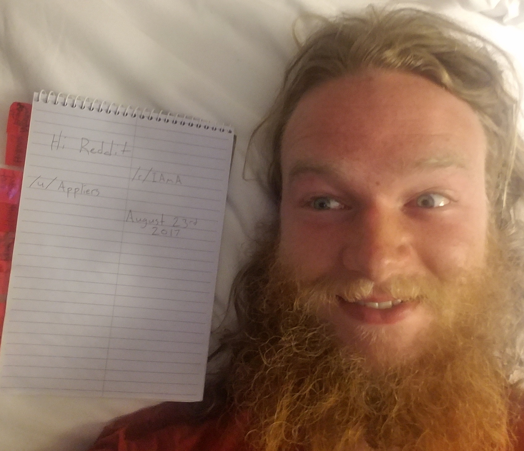
Writing this has given me great pause, which in turn was compounded as the CDT has been generally tougher than I expected, or maybe I just got soft in UT.

I spent a few unexpected zeroes in New Rockford, ND. Only slightly jeopardizing my plans to meet my father at the end of the NCT to slackpack the gap to Glacier. It started after having hitched into town for water, I camped in the RV section of the town park, with plans to hitch back out to where I left off, and maybe camp there once more. It’d be a short day, but I did have a package to pick up in town. After dark someone stumbled over my tent on the way back to their camper, after a brief realization of what they’d  tripped over; in particular that I had no car. They told me that they “Really appreciated what [I] was up to, and that we should hang out in the morning.” I could feel the edge of the vortex pulling me in, but just wanted to get to sleep. So half-awake and halfheartedly I agreed. When morning came, I was surprised to find that my new friend; Chad, had barbed wire tattoos instead of eyebrows, my interest had been piqued. After some introductions I ended up staying with an old lady from town, Julie, whom they hang out with and generally seemed to be helping. We moved a bunch of her furniture, went searching for replacements on curbsides. Picked up a compact dishwasher for Chad’s RV, and a new-to-her refrigerator for Julie, swapped the old one to the curb where the new one was found.

20170421_222034

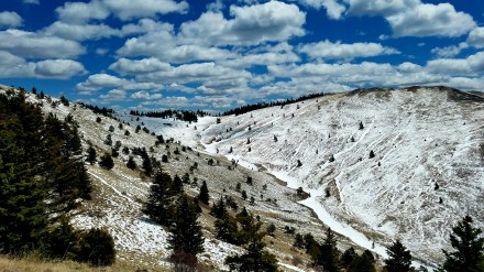
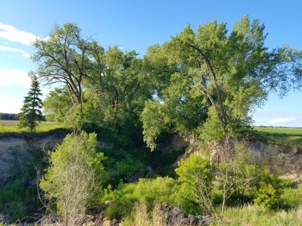
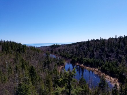
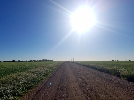
This account is of course abbreviated, many other things happened and people met, including Tarot readings, ritual use of energy crystals, Julie’s daughter and grand-children. I’ve had a tough time turning it into something coherent as is. My longest home-stay since Aunt Kim’s in Michigan, ended rather quietly, during my last morning I hitched out and slack-packed myself back to town from where I had previously hitched to town from, collected my pack and water and headed for the final stretch of the NCT: The McClusky Canal, an unfinished and abandoned canal, which makes up the better part of the remaining 170 or so miles to the NCT’s western terminus. Walking the canal is rough, it is long, it is flat, and the first couple dozen miles were basically dry too. The section of canal line near New Rockford doesn’t actually connect all the way to Lake Sakakawea; there’s about a 15 mile gap where you’re back on roads, or cutting across farmland. After this gap the canal is mostly full of slow or stagnant water, but it is available.

20160619_190635

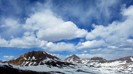
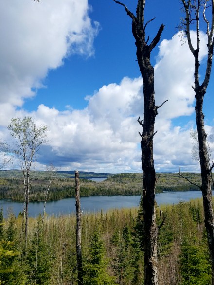
The Canal drops into Lake Audubon, which is only really separate from Lake Sakakawea due to US 83 cutting across via land bridge. I am late in making it here, but its nothing a 24 hour challenge can’t solve, and its easy terrain for night hiking; the canal is lined with a pair of dirt roads. Once you hit the lake its back onto regular roads, tracking alongside the lake with a couple miles of trail leading into Lake Sakakawea State Park for the end of the North Country Trail. The Terminus Sign was absent, having been blown down during a semi recent storm, not with a whimper, or a bang, but a more of a sigh as I meet my Father, and ready myself for the long road walk to Glacier and my next long trail.

Coast to Coast, and Southwestern leg done.

These got swept under the rug for a while, but February 4th I completed my coast to coast objective, making it into the Pacific Ocean at Dunes Park Beach in San Diego, CA.

In addition, I somewhat recently made it to the CDT aswell. Hit the Southern Terminus on March 2nd, walked to Lordsburg NM, and took off to Utah to wait and give the San Juans a chance to melt a little bit by the time I get there in May.

By the time this goes out I ought to be back to hiking on the CDT, but I have been tooling around Southwestern UT for a few weeks now, mostly focused on resting and learning to rock climb.

Sculpture v2: Unexpected, Unexplained.

This little piece of enigmatic metalwork is somewhere on the PCT just South of Casa de Luna, nobody (by which I mean me) knows why its there. At first glance it appears to be an arrow, maybe pointing in the direction of trail, however it is not at a junction and points 30 degrees off trail into a bush. In addition, the fletching is off, leading me to believe that it was meant as a conjunction of the Venus (♀) and Mars (♂) symbols. (it could also be Mars and the modern Earth symbol {♁} but that seems unlikely to me) These symbols in a modern context are often used to refer to gender, and their orientation in this sculpture is rotated, so I think the Artist intends for us to flip gender on its side…?

This may not count as sculpture if your conceptualization of sculpture requires a human artisan, but mine does not and this is the spitting image of an eagle anyway. Eagle Rock is a fixture of the PCT, such that I knew it was coming up, and I had only seen about 3 people on trail (not counting 100 yards from roads, and even including them its not many) in the last 1200 miles of the PCT.

These ended up being on a dead end spur, (I briefly headed towards Los Vegas for a doomed attempt to meet up with Mammoth for a third time.) but a pair of (shī) randomly off route 66? What in the world? They’re just in the desert; they even have registers despite not being on a trail, but no explanation.

On a Plain

Lots of trail magic in Eastern MN, between trail volunteers and random passersby. I had a stretch of nightly hosting, and made a couple new friends. Including Henry, whom gave me a lift back into town during some mild rain wherein we played frisbee golf, ate mango, and talked about mysticism. From town (Fergus Falls) I met up with a friend from home, who was in school nearby at Morris and spent a weekend with him. Which included sorta low-key crashing his friends’ wedding, (that makes two for those of you counting at home) and gorging myself on cupcakes that nobody else seemed to be eating. Met a guy named Dale right on near the border with North Dakota, and after passing me several times just wandering down the road who after getting shot down offering me rides, ended up taking me in for a night. He had a rad Lego collection set up in his living room and a little wooded area with a fireplace that was all done up with Xmas lights and such. In the morning we stopped into his shop where we were greeted by a whole bunch of friendly farm kittens, not quite to the extent as I had seen in OH, but pleasant as all get out nonetheless.

wp-1488514662826.jpg

North Dakota surprised me with how well punctuated it is, however the roadwalks do drag on endlessly and some of the trail seems to be almost through people’s backyards, which can be a little awkward. The lack of shade led me to hike long into the nights, and spend my days in dry shady culverts. The non-corrugated ones are especially nice, although in a pinch you can sit just outside on the leeward side from the sun. The empty night roads  make for a pleasant trek, featuring wide open to the expanses with low horizon lines all around, and populated only by occasional trees, shrub, or ditch. While Its doubtful I would’ve been hassled while sleeping beside the road, I was thankful for my tent’s dark green shade, which likely drew less attention as I tore down camp in the mornings. The days I did hike during daylight hours were brutally hot, retaining much of that Minnesotan Humidity from just across the border. I certainly am a child of winter.

20170302_221457.jpg

Roasting in the sun, if you zoom in you can read the 106 F on my watch, and see the blank horizons beyond. The Shirt is wet with sweat, otherwise the white salt stains would be showing up, emanating from the sternum strap in particular. Luckily (not really, I am sure it was by design.) water was generally available, as the trail tracks the Sheyenne River pretty closely. There is a big gap between the Sheyenne and New Rockford where the Trail picks up the McClusky Canal, hitching back and forth to town for water is pretty weird, and people seem almost a little offended when you ask to get dropped off in the middle of nowhere, but then again, I don’t always jump to explain what I am up to either.

Animals on the Trail v3: Desert Dwellers

This friendly coyote just wants the food I keep on my shoulder straps. The National Parks are a sort of haven for tame animals, assuredly a result of being fed by tourists and seldom hurt by people. Death Valley in particular had many animals willing to approaching well within my comfort zone; however I got the best picture of this coyote, which was one of three I saw pretty close, and a small fox, maybe even a kit!

The Salton Sea is one of the stranger landscapes I have traversed, lined with fish bones and chitinous barnacle shells leave the beach a surreal sort of hellscape, wherein it is consistently possible to sink up to your calves in bleached dry bone. The lake itself smells off, a cross between the ocean, an urban riverfront, and the sulfur springs of a volcano. in the transition area between the water and the fields of organic decay, a small sand bar filled with sea birds, obviously attracted to this large inland body of salt water.

Buzzards circling some expanse, is a little less common than westerns might lead you to believe. I didn’t go near the epicenter to see whose wake these vultures were attending; most likely roadkill, of which I do not shy away from, but it certainly does not draw me in. This guy kinda looks like he is doing an impression of unpopular opinion puffin.

A little horned lizard hiding away in the Northeastern section of Joshua Tree NP, he’s kinda hard to see, but don’t hold it against him; that’s how he stays alive. There was a bit of rain and general humidity relative to the normal desert clime, so the greens have been really bright, but that’ll probably taper off in the coming weeks.

Boundries

The Border Route Trail section, immediately after the Superior Hiking Trail, brought me my dusting of late MN snow. While I had just come off trail to resupply; Nemo was dropping one of our friends off to SoBo the SHT, so we kicked it for a night and he brought me a ration box. Found several unopened beers in the woods, still good even; not in the same place either, like 3 different beers in 3 different places. Hope I didn’t wreck someone’s caches for a drunken FKT attempt… Saw lots of wild life up close, all the baby animals that aren’t afraid of people, or are otherwise foolish. From the moose at a safe distance, to grouse chicks and fawns that try to hide right in the center of the trail. (or worse, under the arch of my boot.) Met Problem Bear briefly on the Kekekabic trail, He’s Triple Crowner who attempted the NCT east bound in 2016. I think he got off in MI around when the trail gets overly civilized. People who can really relate to long distance hiking are pretty rare the farther you get from the Triple Crown Trails, so I think we both enjoyed taking an hour to commiserate.

wp-1487302165198.jpg

I caught both the BRT and Kek before many of the volunteers had been out for the heavy trail maintenance necessary. Many dead-falls and Aspen were bent across the trails; likely a hold over from heavy snows or a fall windstorm; slowing progress about as well as any of the steep elevation jumps of the AT and the LT, as following the trail became less walking and more tracing a tread path through a thicket that grows sideways. Leaving the Kek and the boundary waters I was able to connect with a group of volunteers who put me up in a boy scout camp near the Kek’s terminus, and also fed me pretty decent before I set off on the next decent road section. MN was good to me, even on roads; people offered me rides, food and drink multiple times a day between Ely and my next trail section just after Grand Rapids. (These great lakes states seem to share town names pretty frequently…) Good to have “Minnesota Nice” be more true than just a series of passive aggressive jokes.

wp-1487312142383.jpg

This road section is about when I really got on top of this iteration of the blog, and I think when I got onto instagram. The next section of established trail is well supported by trail volunteers and came and went quite breezily. Here I found my first morel mushrooms, which at the time I thought were quite sizable, as well this section was where I had to step over a fawn that failed its hide check. (or maybe just balance…) I ran into an encryption error, and accidentally erased all the pictures I took in Minnesota to this point, so the ones that have made it here I have found because as luck would have it; I didn’t back up anything in that time, but I did transfer files around a little so there were a few survivors. You’d think that afterwards I would’ve learned my lesson and developed good habits around back-ups and data management, but I actually recently had another near catastrophe… maybe I ought to get around to that…

Winter v2: Frozen Deserts

Overall, winter seems to only come in a few flavors on trail. Some such as while crossing the Inyos for this look into Saline Valley, are amongst my favorite hiking conditions, and it might be a stretch to even call them winter. Cool air, comparatively warm sun. I’ve said it before, but this kind of weather inspires big mile days more than any other.

Similar weather abounded in the desert sections of the PCT, especially after I came down from the high points near San Jacinto and Onyx Peak; where conditions dipped into another flavor of trail winter, too windy and wet to stop and fiddle with Cameras. Luckily it didn’t stay that way for too long. The overarching plan to spend winter in the Southwest is working out, almost too well. Its maybe a bit hot for me at these lower elevations.

Herein upon Muir Pass I having had a bit of this second flavor of winter, but was also determined to try to photograph my surroundings. It helped that I could hop in and out of the Muir Pass Hut for refuge as need be.

Another, more literal flavor of winter camping is while snow may not be present, temperatures are low enough that you can pack ice cream out from town for you first breakfast. I would encourage this universally, everyother non-cooked meal you eat will already be equally cold.

Winter flees the North Shore

While still quite early for the Superior Hiking Trail’s season, my delays found me on trail with atleast one other thru hiker according to the registers. A little slack packing out ofy parent’s cottage in duluth, compliments of my father, (who seems to like slack packing quite a bit, seeing as he offers to do so not infrequently.) and I was back up to speed. The eastern most 400 miles of the NCT in MN are truly a joy; minimal roadwalking enough elevation change to stave off boredom, without being particularly difficult, plentiful and beautiful waterways. I may be a bit biased, as the SHT was my first thru-hike, and is in my home state, but this is the best section of the NCT; barring maybe the High Peaks area of the Adirondaks, which was nowhere near as long, but more spectacular, and not the official NCT route.

After the long and lonesome winter, having the occasional company at camp was nice, on trail as well although I seldom stop to chat for long. I passed several different trail crews all out for their first outings of the season, and even met Lars again and nighted with his family near Oberg Mt. (Which was fortunate, as I forgot my trekking poles with him when he ferried my back to the Twin Cities.) Shortly thereafter I happened to camp with another thru hiker which I hadn’t quite expected. I figured I would probably pass them at night while they were camped out. It was their first thru, and they were having some minor struggles regarding a hiking partner getting back on trail after having gotten hurt. I think I shared some cookies with them, hope they managed to finish

The atmosphere this time through the SHT was wholly different from my previous thru, in which it was much drearier, was also off season. I don’t recall this bridge being as sketchy then (heard they’ve already fixed it even) but I have a kind of fixation on failing trail infrastructure. When I previously passed thru, overcast skies lent a certain mystique to the riverwalks. Low visibility lent the rock formations additional gravitas, as they disappear into fog only 10 feet away. This time I had few clouds, although for a couple days they showed up bearing a dusting of snow in the far north. I’ll count that, and with it I had snow in every state of the NCT save ND.